Yosemite is one of my favorite California destinations. There are several easy hikes in Yosemite National Park, so nature and beauty are very accessible.
Most people spend their time in the Yosemite Valley, but the park is huge! Areas like the high country of Tioga Pass and the sequoia groves of South Yosemite should be included on your hiking itinerary. Here are my 16 favorite easy hikes in Yosemite.
Yosemite is one of 75 California Landmarks to See Before You Die.
Important to know: Yosemite National Park recently announced that it will require reservations for select dates April through October, 2024 in order to decrease overcrowding in the park.
From April 13 through June 30, a reservation is required from 5am – 4pm on Saturdays, Sundays, as well as May 27 and June 19, which are government holidays.
From July 1 through August 16, a reservation is required from 5am – 4pm daily.
From August 17 through October 27, a reservation is required from 5am – 4pm on Saturdays, Sundays, as well as September 2 and October 14, which are government holidays.
Reservations are also required in February during “Firefall season” when Horsetail Fall can glow orange when it’s backlit by sunset, which can make it appear to be on fire. These dates are February 10 -11, 17 – 19, and 24 – 25 in 2024.
Reservations will begin being released on January 5 at 8am and be available in advance. Some afternoon reservations and full-day reservations will be released one week in advance of the date as well.
Easy Hikes in Yosemite Valley
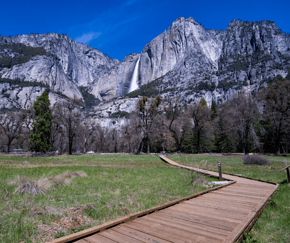
1. Lower Yosemite Falls
Distance: 1 mile round trip
Elevation Change: 50 feet
There’s a reason that the walk to the base of Yosemite Falls is one of the most popular hikes in Yosemite National Park. The walk to Lower Yosemite Falls is almost entirely flat and the entire loop is paved. Plus, the view from the base of the falls is amazing!
Lower Yosemite Falls are especially impressive during the spring snowmelt. During this time, the waterfall is raging, and the spray close to the falls on the bridge is constant.
Yosemite Falls can completely disappear (or be nothing but a trickle) from late summer until the rain starts again in mid to late fall.
You can reach Yosemite Falls on the Yosemite Valley shuttle by getting off at shuttle stop 6. Here is a map of the free Yosemite Valley Shuttle service.
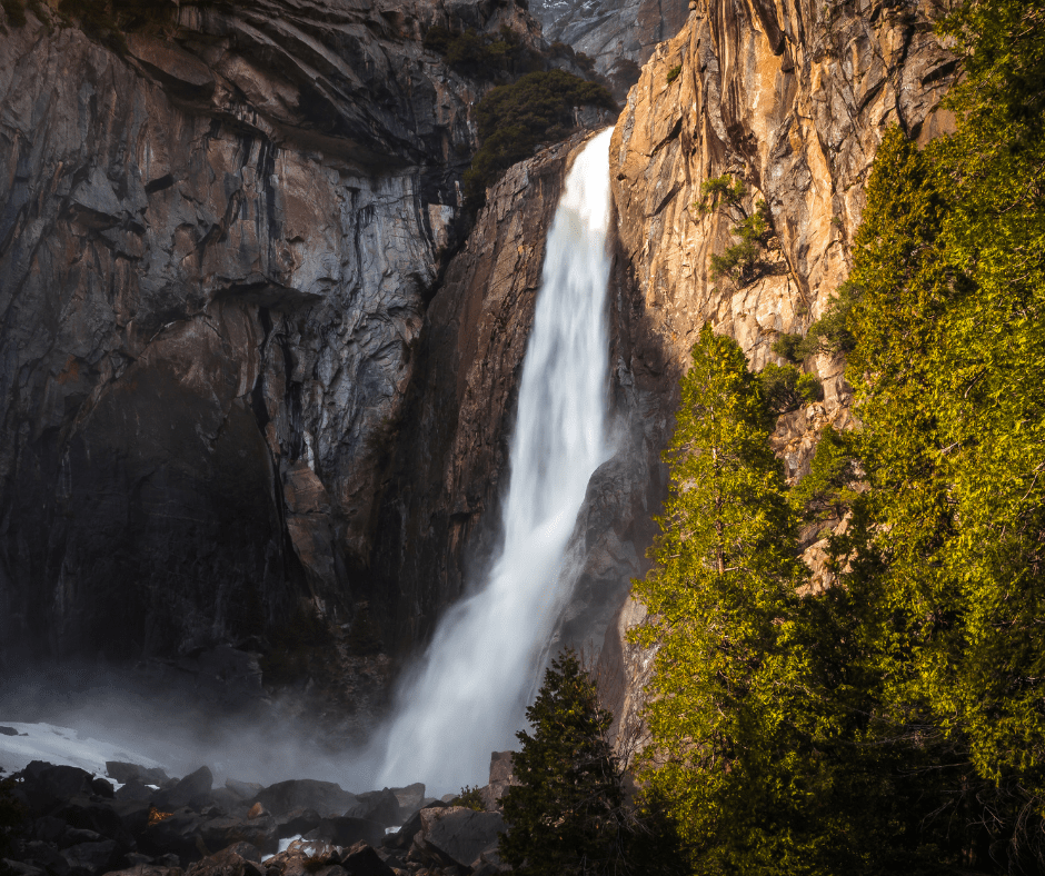
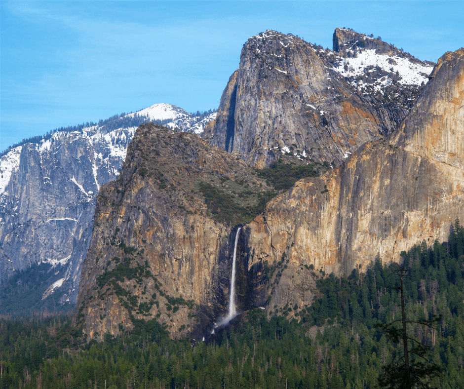
2. Bridalveil Fall
Distance: 1/2 mile round trip
Elevation Change: 80 feet
The walk to Bridalveil Fall is one of the easiest hikes in all of Yosemite Valley. It is a short, quarter-mile jaunt to the base of this 620-foot waterfall.
The trail is paved and this waterfall runs year round. You will usually be able to feel the spray from the falls when you are close to the base which is quite refreshing on a warm day.
Bridalveil Fall is often one of the first stops people make as they are driving into Yosemite Valley. Park your car for a quick pit stop before heading into the main part of Yosemite Valley. There is no shuttle service to the waterfall.
3. Mirror Lake
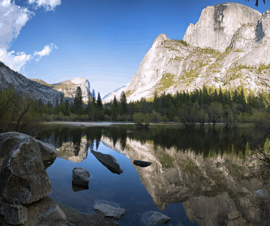
Distance: 2 miles round trip
Elevation Change: 100 feet
Mirror Lake is a lovely place to enjoy in the spring and early summer when it is most full. During the snowmelt, you can gaze at the lake and enjoy the reflection of the surrounding granite cliffs. By late summer, it is very small and not much to look at.
The trail to Mirror Lake is a popular family hike. Mirror Lake is accessed via a paved road, making this a great trail for strollers and bikes. You can access the Mirror Lake Trail via shuttle stop 17.
The elevation gain is slight until the final quarter mile when it heads steeply uphill. Many families ride bikes the first 3/4 of a mile and then walk the final stretch.
You can extend your hike to 5 miles by taking the loop that follows Tenaya Creek, crosses two bridges and returns to Mirror Lake.
4. Cooks Meadow
Distance: 1 mile round trip
Elevation Change: Minimal
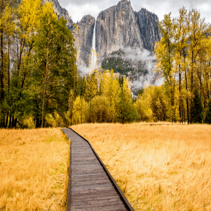
Cooks Meadow is a wonderful place to take some great shots of the Yosemite Valley, especially during the “golden hour”. It is a simple, flat 1-mile loop with great views of Valley stunners like Half Dome and Yosemite Falls.
The path is paved in some sections and a boardwalk in others. It can be accessed via the Sentinel Bridge Parking Area at shuttle stop 11 or via shuttle stop 6 across the street from the Lower Yosemite falls trailhead.
I suggest combining this trail with the Sentinel Meadow Trail for a 2.25-mile loop. On this loop you will have the chance to cross two bridges over the Merced River and get some exceptional pictures.
Note: This is also a great loop to bike. Bring your own or rent from the stand near Yosemite Valley Lodge.
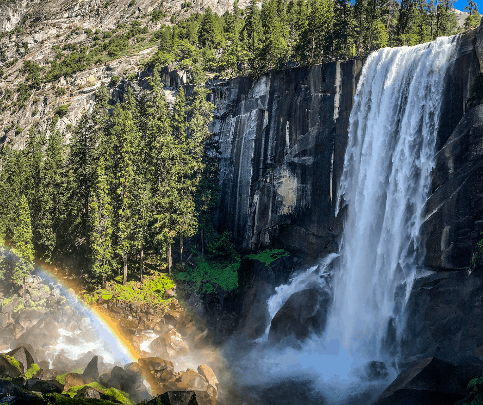
5. Mist Trail to Vernal Fall Footbridge
Distance: 1.6 miles round trip
Elevation Change: 400 feet
This is the most difficult of the easy hikes in Yosemite Valley. It isn’t a particularly long hike, but it is uphill on the way to the falls.
The Mist Trail is very popular, as people heading to Vernal Fall, Nevada Fall, and points further all use this trail. Still, the hike uphill is worth the effort because the view of Vernal Fall from the footbridge is incredible.
You can continue uphill another .4 miles to get a view from the top of Vernal Fall. Expect to get wet from the fall’s mist as you climb the stone steps (this is how the mist trail got its name).
The Mist Trail can be accessed on Yosemite Valley shuttle stop 16.
Easy Hikes in Yosemite Near Glacier Point
7. Glacier Point Trail
Distance: 1/3 mile round trip
Elevation Change: Minimal
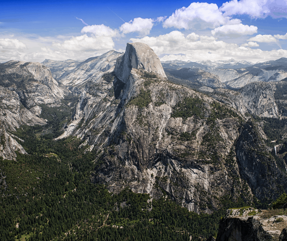
This is much more of a walk from the parking lot than a hike, but it is certainly something you won’t want to miss. Glacier Point is located high above the Yosemite Valley, and the views are mesmerizing.
Gazing down at Curry Village 3200 feet below, the cars in the parking lot look like ants! You can take in the entire valley from up here, as well as High Sierras.
El Capitan looks small from Glacier Point and Half Dome is near eye level, instead of towering above.
8. Sentinel Dome
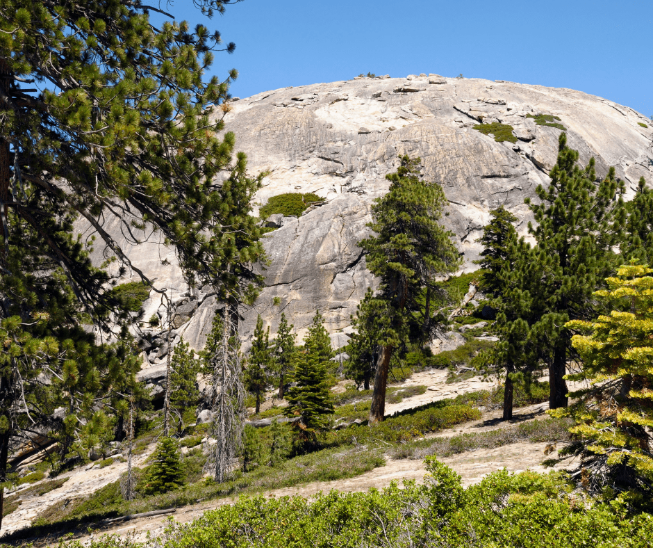
Distance: 1.8 miles round trip
Elevation Change: 400 feet
The climb to the top of Sentinel Dome gives you great views of the Yosemite Valley, Half Dome, and the High Sierras as well, but the perspective is different and crowds are far fewer.
Most of the trail is on exposed granite, which can be slippery during rain. But when its dry, it is a breeze to walk on. Walking up the side of the dome is fun, and the 360-degree views are wonderful.
9. Taft Point
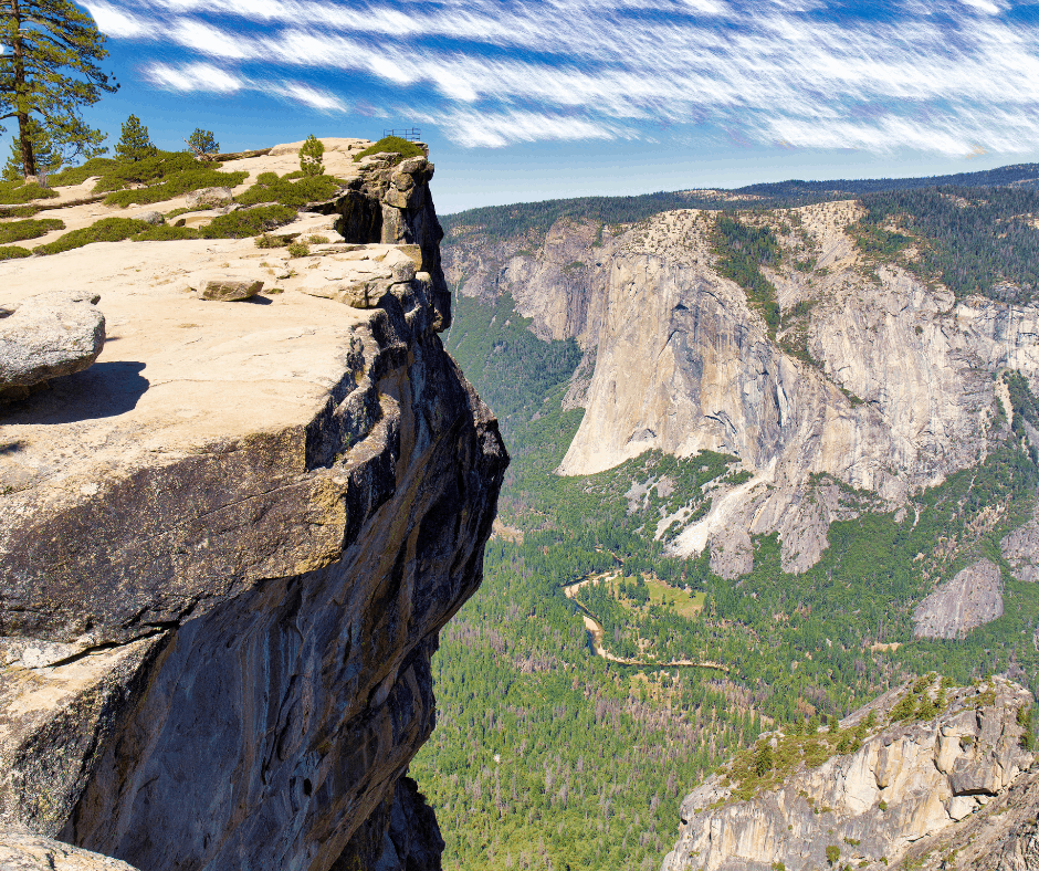
Distance: 2.2 miles round trip
Elevation Change: 200 feet
Have you ever seen photos of people standing on a granite cliff fissure with the Yosemite Valley thousands of feet below? These heart-stopping photos were taken near Taft Point.
This hike isn’t for those who are easily freaked out by people standing near cliff’s edges (like me), but you can get some pretty amazing photos if you are brave enough to walk out to cliff’s edge.
The trail meanders through a meadow as its makes it way to the Point. There is a railing at Taft Point, but not the surrounding edges. This is the place to go to enjoy views of the southern portion of Yosemite Valley, including Yosemite Falls and El Capitan.
Easy Hikes in Yosemite in Tioga Pass
The Tioga Pass area is quite different from the Yosemite Valley; this is High Sierra territory. Tioga Pass is typically open from around Memorial day until October, contingent on snowfall.
There are far fewer people in this part of the park and several lovely hikes to enjoy. Pack mosquito repellent because those buggers are vicious, especially near standing water.
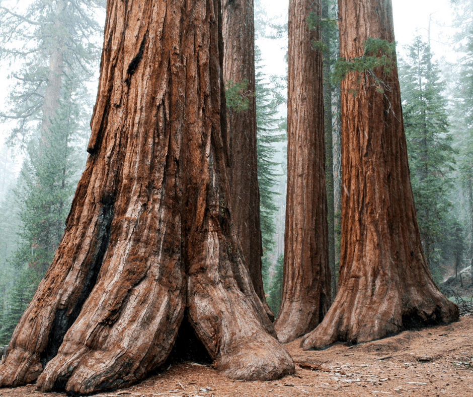
10. Tuolumne Grove
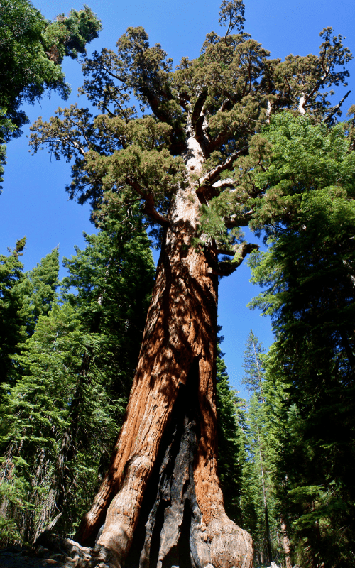
Distance: 2.5 Miles round trip
Elevation Change: 400 feet
Not long after you turn onto Tioga Road coming from the Yosemite Valley (as well as the south and west sides), you will see a pull off for the Tuolumne Grove of giant sequoias.
Unlike most hikes in Yosemite this one heads downhill first, which means the huffing and puffing are done on the return. Still, the trail is wide and smooth and not overly steep.
Standing beneath some of the largest trees on the planet is worth a little uphill jaunt on the way back. There is a large parking lot near the trailhead.
11. Tenaya Lake
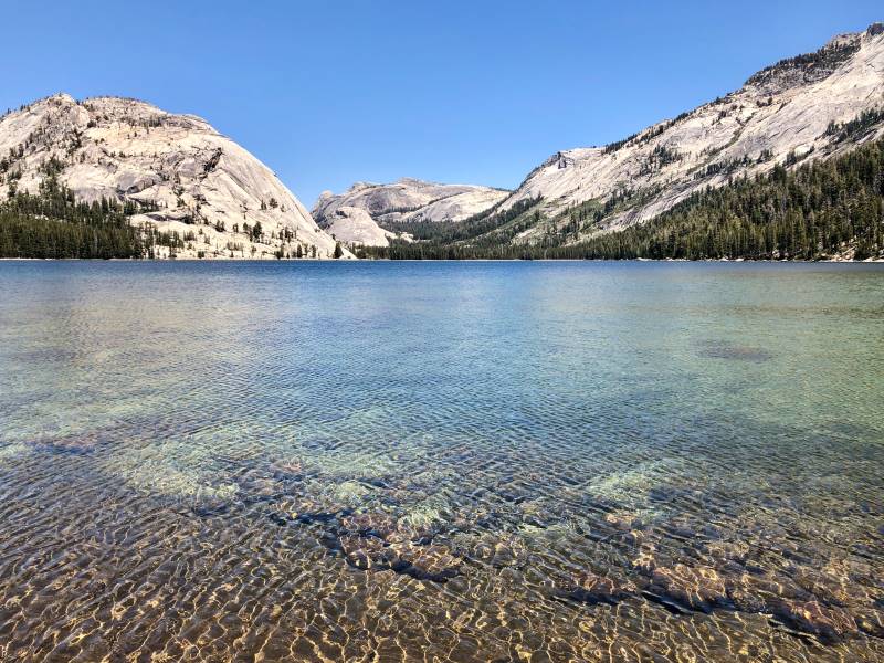
Distance: 2.5 miles for the full loop around the lake
Elevation Change: Minimal
Tenaya Lake is a lovely High Sierra lake at 8150′ in elevation. One of its shores hugs Tioga Road. There are several different places to park near the lake as well as picnic benches.
It is a popular place for sunbathing and splashing in the water during the peak of the summer, but the weather is always considerably cooler than it is on the valley floor.
There is a trail that loops Tenaya Lake. The full loop is 2.5 miles but you can make this hike as long or short as you would like. The lake is the main attraction.
If you choose to do the full loop you will need to cross the lakes inlet and outlet which can be easy in the late summer but might involve getting your feet wet in the earlier part of the summer.
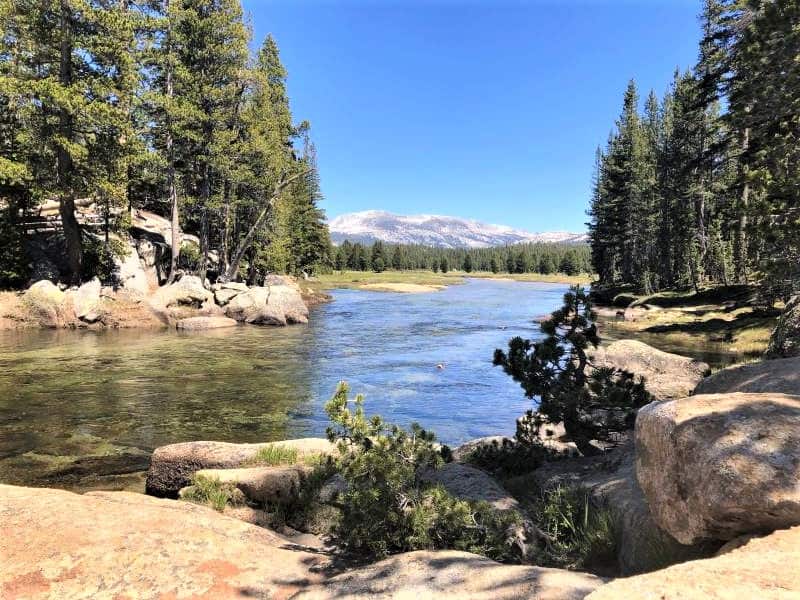
12. Tuolumne River Cascades via Pothole Dome
Distance: 2.4 miles round trip
Elevation Change: Minimal
I hate using the term “hidden gem” but this trail truly is. It is not a trail that is listed on brochures provided by the park and it is largely overlooked.
The trail begins at the parking area near Pothole Dome and heads along the road towards the Dome until you reach the base. Many people start climbing up the dome from there.
You can certainly climb the dome- the views are wonderful- but it is a bit steep and doesn’t really fall into the “easy category”. But to enjoy this hike, keep following the trail as it goes past the granite dome and hugs the edge of Tuolumne Meadows, winding in and out of the forest.
After a little more than a mile you will reach the Tuolumne River which is picture perfect, especially during the snowmelt. You can continue to follow the creek for quite a while by scrambling on the granite that hugs the river and the occasional path.
Or you can just sit and enjoy the cascades for a while. River’s edge is an ideal place for a picnic.
13. Tuolumne Meadow to Soda Springs
Distance: 1.6 miles round trip
Elevation Change: Minimal
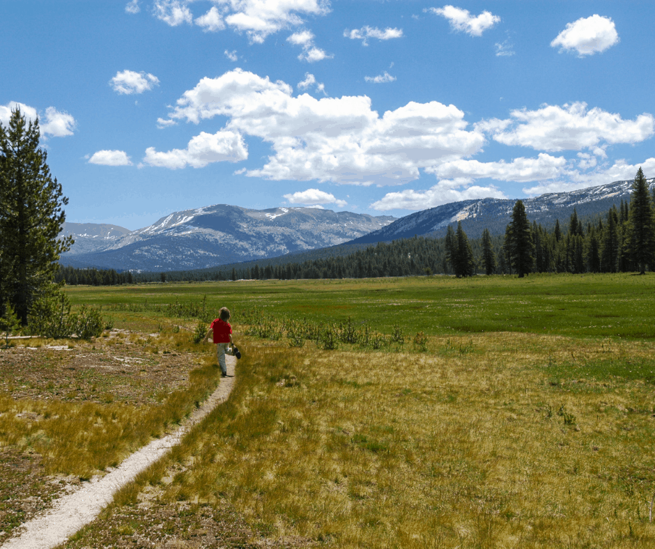
Tuolumne Meadows is an exceptionally beautiful place during the early summer when this expansive meadow is a carpet of green and wildflowers.
This hike can begin at two different spots, either the parking area alongside Tioga Road in front of Tuolumne Meadow or from the parking lot near the Lembert Dome trailhead.
Both routes ultimately reach Soda Springs, a carbonated spring with a reddish tinge, and Parson’s Lodge, a 100-year-old stone building that houses some small exhibits and provides refuge from sudden storms.
Easy Hikes in South Yosemite
South Yosemite is a popular spot to enjoy sequoia trees, cabin stays, and the popular Yosemite Mountain Sugar Pine Railroad, but it also has some nice hikes.
14. Mariposa Grove
Distance: 0.3 miles on the Big Tree Loop, 2 miles on the Giant Grizzly Loop
Elevation Change: Minimal on the Big Tree Loop and 300 feet on the Giant Grizzly Loop.
The Mariposa Grove of Giant Sequoias is located just two miles from Yosemite’s southern entrance. There are about 500 sequoia trees in this grove.
If you are in a big hurry and just want to see the famed Fallen Giant, a massive sequoia that fell long ago, take the Big Tree Loop.
But to really see more of the highlights, you want to make your way to the massive Grizzly Giant tree and the California Tunnel Tree, which you can walk through.
If you take the full loop it is 2 miles. But you can shorten it by hiking out and back to the Grizzly Giant, past the Fallen Giant and California Tunnel Tree and will end up with a 1.6-mile hike.
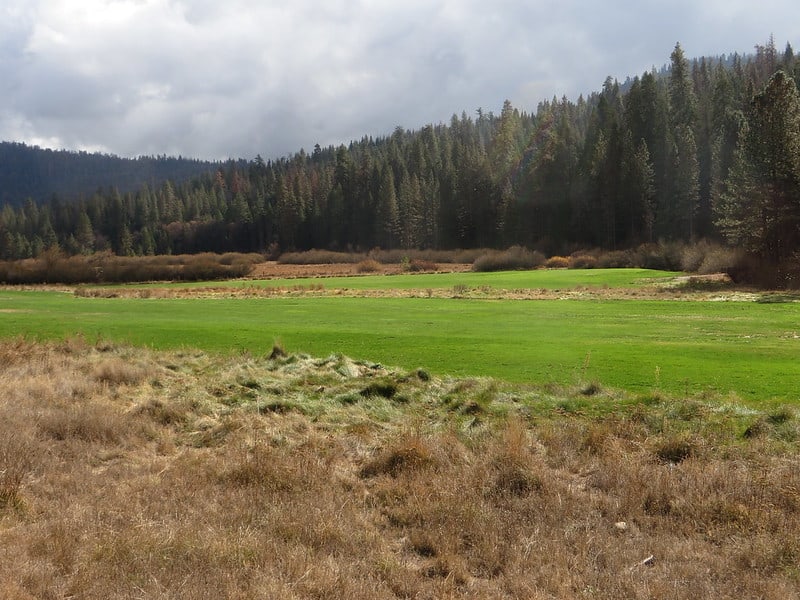
15. Wawona Meadow Loop
Distance: 3.5 mile loop
Elevation Change: Minimal
The Wawona Meadow Loop trail is a great place to enjoy a nature walk because there are plenty of things to discover right along the trail.
During the spring and early summer, there are wildflowers aplenty. There are also streams to explore, and animal tracks to identify.
You might even bump into a few of Wawona’s horses – they share this path with hikers during the summer.
16. First Cascades of the Chilnualna Falls Trail
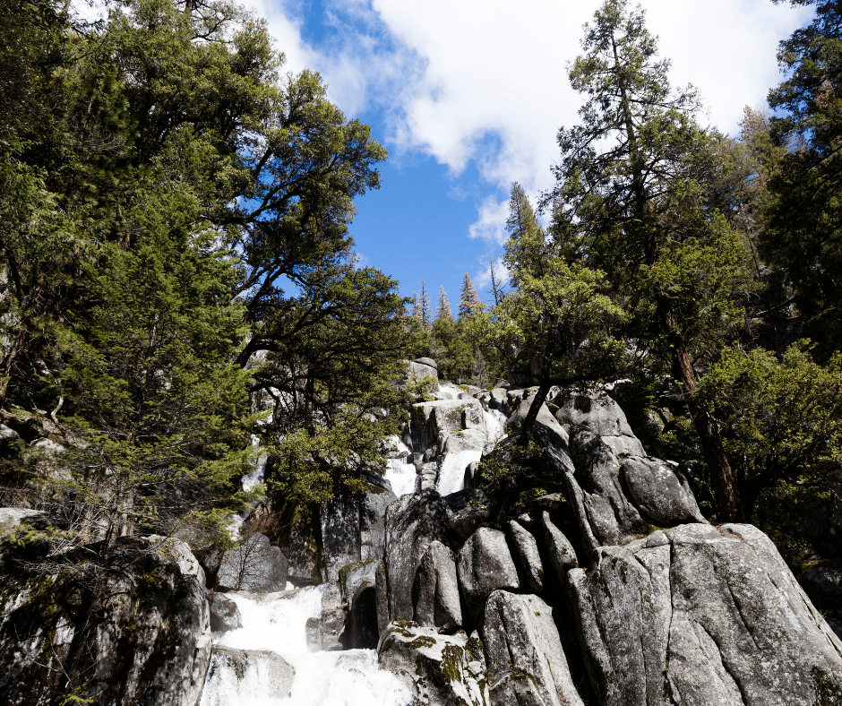
Distance: 1/2 mile round trip
Elevation Gain: About 200 feet
The full Chilnualna Falls Trail is about 8.2 miles round trip and is a wonderful day hike, but certainly doesn’t fall into the easy category.
Luckily, there is still a nice option on this trail for a short but sweet trek to some small cascades. The trail forks at the trailhead- left is for horses and right is for hikers only. Take the right for and you will come across some nice cascades.
If you want to make it into a longer hike, hike another mile and a half up the trail until it rejoins the river. This is a good spot to have lunch before heading back down the hill.
As with most falls and rivers in Yosemite, Chilnaulna runs faster and harder during the spring and early summer.