
Mammoth Lakes is an Eastern Sierra paradise home to dozens of lakes, steep granite mountains, and plenty of geologic formations to remind us all of the volcanic activity happening below the surface. Mammoth hikes are as diverse as the landscape around the town, but they all seem to manage to pack in the “wow factor”.
Here are 10 of my favorite hikes in and around Mammoth. They include waterfalls, lakes, national monuments, and lots of picture-perfect scenery. Use Mammoth Lakes as your home base as you explore this lesser-visited section of the Sierra Nevadas. Be sure to be mindful of current conditions before you head out, especially during heavy snowpack years which can delay trail openings.
10 Mammoth Hikes You Won’t Want to Miss
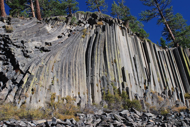
1 . Devil’s Postpile and Rainbow Falls
Distance: About 5 miles round trip
Elevation Change: About 550 feet.
The hike to Devil’s Postpile National Monument and Rainbow Falls is one of the most popular in the Mammoth Lakes region, for good reason- you will be able to enjoy two incredible natural landmarks in one day hike.
It is only a 0.4-mile hike from the small parking area near the trailhead/shuttle stop on a well-maintained trail to reach Devils Postpile.
Devils Posptile is an impressive formation made up of towering hexagonal basalt columns that were formed by volcanic activity about 100,000 years ago. The volcanic lava that formed the columns cooled slowly, causing it to contract and crack into the polygonal shape that we see today. These columns are some of the most well-preserved examples of basalt columns in the world, with some standing up to 60 feet (18 meters) tall.
Devil’s Postpile is one of 75 California Landmarks we think you should visit. How many have you visited so far?
The trail skirts the edge of the columnar basalt formation but there is another spur trail you can take which will lead you up ot the top of Devils Postpile where you can walk on the top of the hexagonal columns.
After exploring the formation, continue on the trail to Rainbow Falls which is a little over two miles further. There are portions of the trail that are recovering from fire, but it is really neat to see new trees and growth.
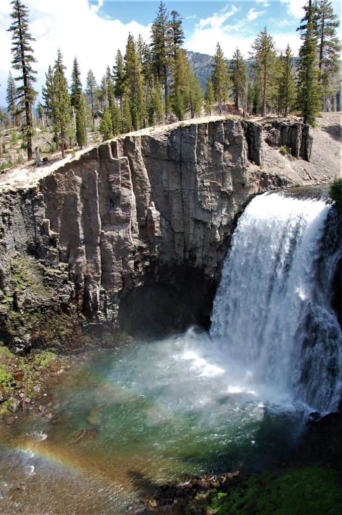
Rainbow Falls large waterfall cascades down a 101-foot drop, creating a rainbow mist in the sunlight. I have seen two rainbows at the same time on particularly sunny days. It is the most impressive waterfall in the Eastern Sierra. The trail leads you to a viewing area, but you can take a spur which winds down to the base of the falls if you want.
During the summer, visitors must take a shuttle from the Mammoth Mountain Adventure Center to access the monument. There are a few stops on the shuttle, including the ranger station and Reds Meadow.
If you are taking the shuttle, you may want to consider taking the trail from Rainbow Falls to Reds Meadow to enjoy a milkshake from the legendary Mule House Cafe, a popular stop for through-hikers on the Pacific Crest Trail. There are also horseback rides available here. The shuttle picks up at Reds Meadow, so there is no need to walk back to the trailhead.
Mammoth Lakes made our list of the best Northern California weekend getaways. See what other special spots we think you should visit!
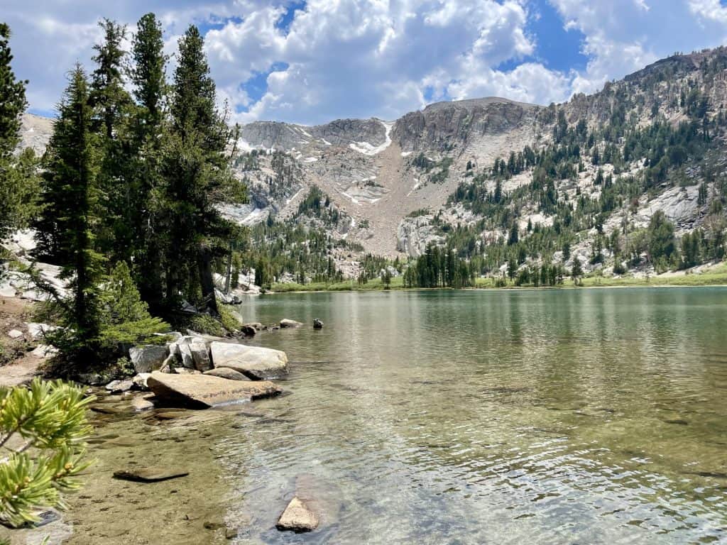
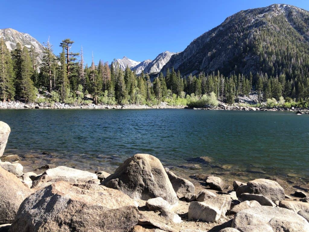
2. Crystal Lake
Distance: About 3 miles round trip
Elevation Change: 800 feet
If you are looking for a workout with plenty of views of Mammoth Lakes along the way, take the series of switchbacks up to Crystal Lake. You will gain a little over 800 feet in elevation on the 1.5-mile route up, but the view, especially off the spur trail which overlooks all the lakes below, is splendid.
The trailhead begins at the Lake George parking area in the Mammoth Lakes Basin. Dogs are allowed on the trail but they must be leashed. It is moderately challenging, with some steep sections and rocky terrain, but the breathtaking views along the way make it worth the effort. Keep your eyes out for wildflowers like lupine, paintbrush, Indian paintbrush, daisies, mountain bluebells, and columbines.
Along the way, you will also be able to see panoramic views of the surrounding mountains, including the Minarets and the Ritter Range as well some of the lower lakes in the Mammoth Basin.
Crystal Lake itself is a glacial lake that sits at an elevation of approximately 9,750 feet (2,972 meters). It is known for its crystal-clear waters and stunning reflection of the surrounding mountains. The lake is also a popular spot for fishing and swimming, but the water is very cold since it is the result of snowmelt.
3. Sherwin Lakes
Distance: About 5 miles round trip
Elevation Change: 880 feet
Another great option in Mammoth (but not in the Mammoth Lakes Basin) is the trail to Sherwin Lakes. This popular trail leads to two beautiful alpine lakes surrounded by towering mountains. The trailhead begins at the Sherwin Creek Road parking area which is on the eastern side of town closer to Old Mammoth and Snowcreek, less than 10 minutes from downtown Mammoth Lakes.
Sherwin Lakes is considered moderately challenging, and does have its share of switchbacks but most of it isn’t too steep. Hikers will pass through forests of pine and aspen trees, rocky outcroppings, and meadows filled with wildflowers. Along the way, they will also be able to see panoramic views of the surrounding mountains, including the Sherwin Range and the Mammoth Crest.
The first lake, Lower Sherwin Lake, is approximately 2.2 miles from the trailhead and is known for its crystal-clear waters and scenic reflections of the surrounding mountains. The second lake, Upper Sherwin Lake, is approximately 0.5 miles beyond Lower Sherwin Lake and is surrounded by rocky cliffs and towering peaks. Both lakes are popular spots for fishing and swimming, but the expect the water to be plenty cold.
4. Convict Lake Trail
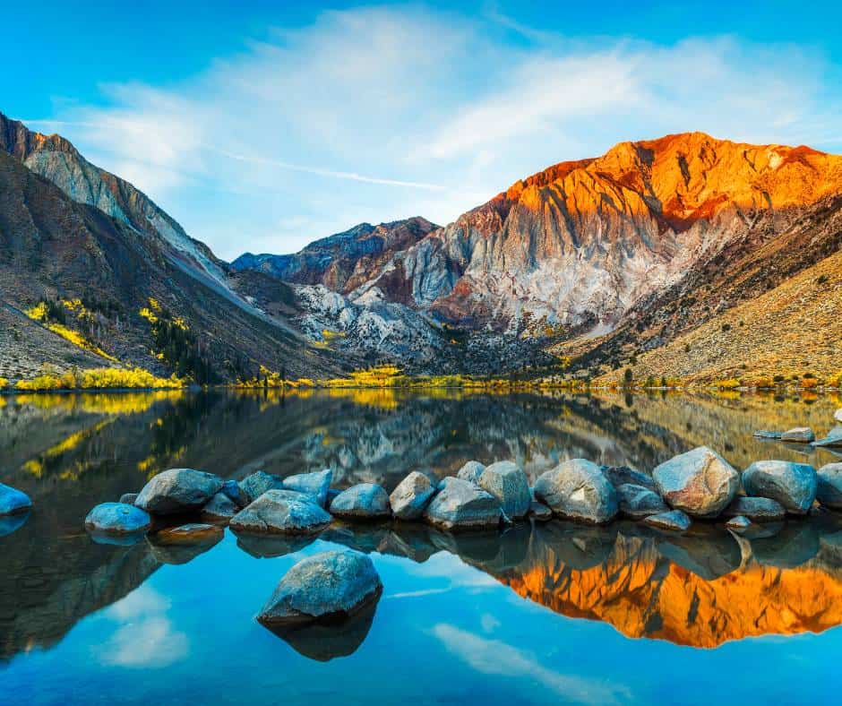
Distance: 2.5 miles round trip
Elevation Change: minimal
The Convict Lake trail is a popular hiking trail south of Mammoth just off Highway 395 that follows a loop around the lake. The trailhead begins at the Convict Lake parking area, and gently winds around the lake.
The trail features several interpretive signs that provide information about the area’s history, geology, and wildlife. It passes through an aspen grove that is especially pretty when it turns brilliant gold shades during the fall.
There is also a portion of the trail that is a boardwalk that crosses over inlet streams that can be running pretty strong when the snow melts.
The lake itself is surrounded by towering mountains, including Mount Morrison, and is known for its crystal-clear waters that reflect the surrounding peaks. In addition to hiking, Convict Lake is a popular spot for fishing, kayaking, and paddleboarding. Visitors can rent boats or kayaks at Convict Lake Resort, located near the trailhead.
5. Parker Lake
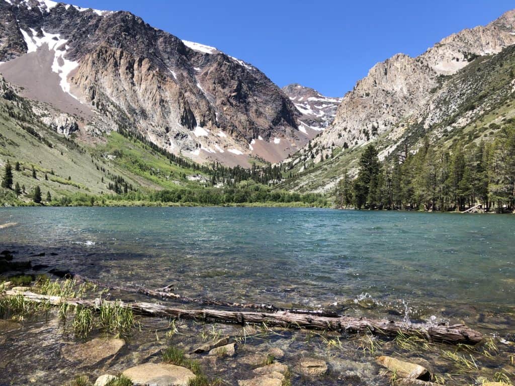
Distance: 3.6 miles round trip
Elevation Change: 650 feet
One of the best hikes for families in the area is the trail to Parker Lake, a gem of a lake located on the south side of the June Lake Loop. The hike is just over 3.5 miles round trip and the reward is a peaceful lake framed by 12,000-foot peaks.
In order to reach the trail you will have to navigate a dirt road for a couple miles, but we found the dirt road to be no trouble for our two-wheel drive vehicle.
The trail begins with relatively little tree cover but it doesn’t take long to reach aspen and pine trees.
Parker Creek runs along a portion of the trail and is a fun place for families to play. The creek is crystal clear and there are both brook trout and brown trout in the lake and creek, so if you like ot fish don’t forget your poles!
Once you reach Parker Lake the trail largerly disappears but you can do some scrambling around water’s edge if you are so inclined. We saw a waterfall on the opposite end of the lake that we attempted to reach but our efforts didn’t get us close to the falls.
6. Little Lakes Valley Trail
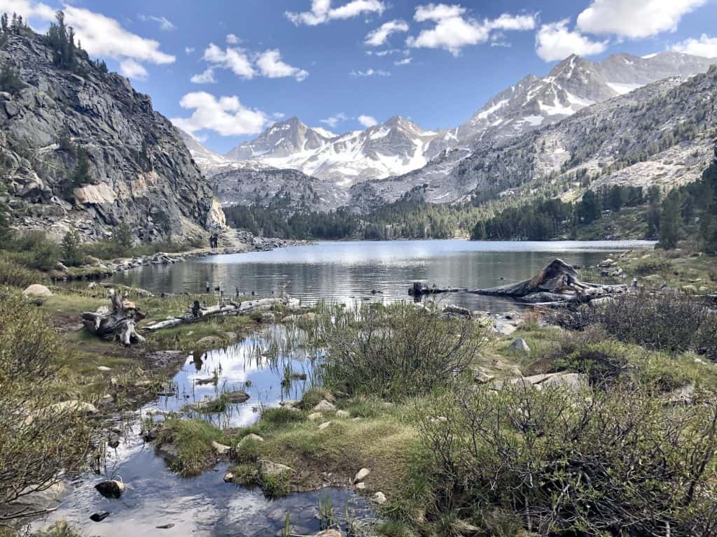
Distance: Eight miles round trip
Elevation Change: 1,000 feet
About 15 minutes south of Mammoth Lakes down HIghway 395 is the exit for Tom’s Cabin. Take that exit and make your way up Rock Creek Road for 10 miles. Before long, you will be whisked away into an Eastern Sierra wonderland.
The last portion of the road to the trailhead is dirt but suitable for two-wheel drive vehicles. It will end at Moquito Flats where you will find the trailhead. Little Lakes Valley is popular with backpackers, but it also makes for an incredible day hike, leading you past seven lakes along the way. Leashed dogs are welcome on this trail.
If you want to find a parking spot neaar the trailhead, arrive early! This is easily one of the most scenic day hikes in all of California and the parking area is relatively small, so plan on arriving before 7am to guarantee a spot. You may aso get lucky and find a spot in the afternoon after the first round of day hikers ends their day, but I wouldn’t count on it!
There is a 1,000 foot elevation gain along the way but it is very gradual up to Long Lake and not challenging, expecially if you have already adjusted to the high elevation. Mosquito Flats is at 10,215 feet in elevation so this is high alpine hiking folks!
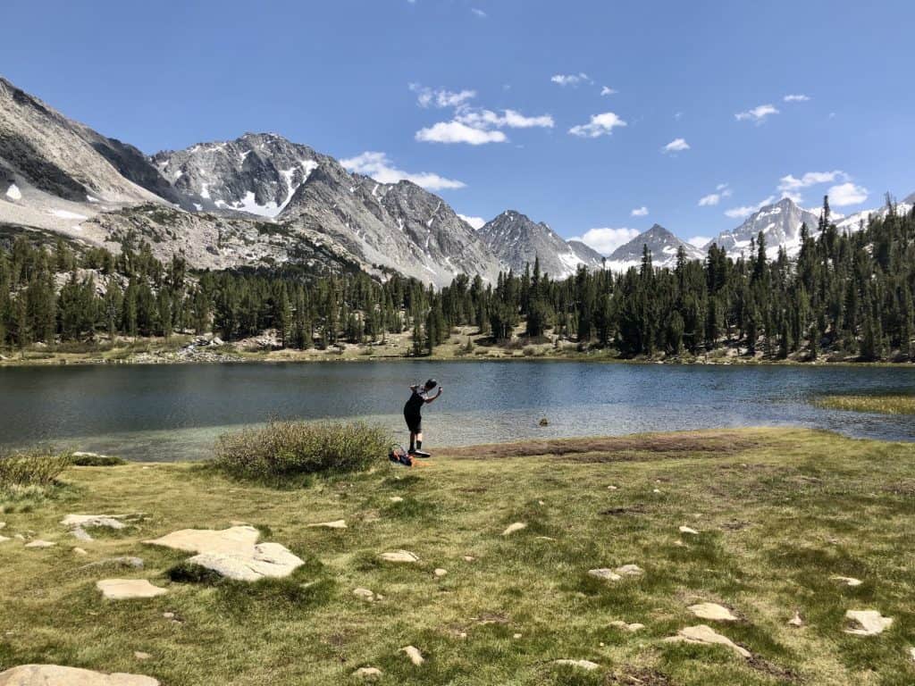
Follow the Little Lakes Trail as it passes by Mack Lake, Marsh Lake, Heart Lake, Box Lake, Long Lake, Gem Lake and Chickenfoot Lake. Each one has its one charm and beauty. The entire route is about four miles in each direction, but hikers can simply go as far as they would like and turn around.
I think the most beautiful lake on the route is Heart Lake and the fishing seems to be quite good at Long Lake. We could see plenty of fish swimming about in the lake’s freezing but clear waters.
Be sure to pack plenty of water and sunscreen on this hike. The thin air makes everything more intense. This trail is generally available May through Septemebr but opening dates are greatly affected by snowpack.
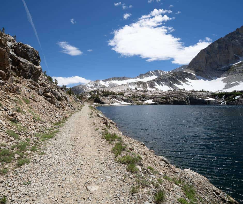
7. Twenty Lakes Basin and Saddleback Lake Loop
Distance: 7.7 miles round trip
Elevation Change: About 900 feet
Mammoth Lakes is a great home base for exploring the Eastern Sierra, including the region near Lee Vining and Tioga Pass. As you are approaching the eastern entrance of Yosemite National Park via Tioga Pass, you will see a turnoff to Saddleback Lake Road.
At the end of Saddlebag Lake Road is a great hike known as the Saddlebag Lake Loop, When this loop is combined with a visit to several of the little lakes that dot Twenty Lakes Basin, it makes for a great day hike.
In all, the entire loop is about eight miles long, and the best way to enjoy the scenery is to go about it in a counterclockwise direction. High peaks dominate the scenery, including Mount Conness, which towers over the basin at 12,590 feet.
The hike begins above 10,000 feet in elevation and gains another 900 feet along the way but the grade is mostly gradual and not terribly challenging.
In addition to nine lakes, lots of high peaks, and wildflower-dotted meadows, you may get lucky enough to see wildlife such as yellow bellied marmots, deer, and bears. Be sure to give wildlife plenty of space as you pass by.
In summer months, there used to be a boat taxi that would take you across Saddlebag Lake and allow you to shorten your hike, but the water taxi did not operate in 2022 and its current status seems to be up in the air.
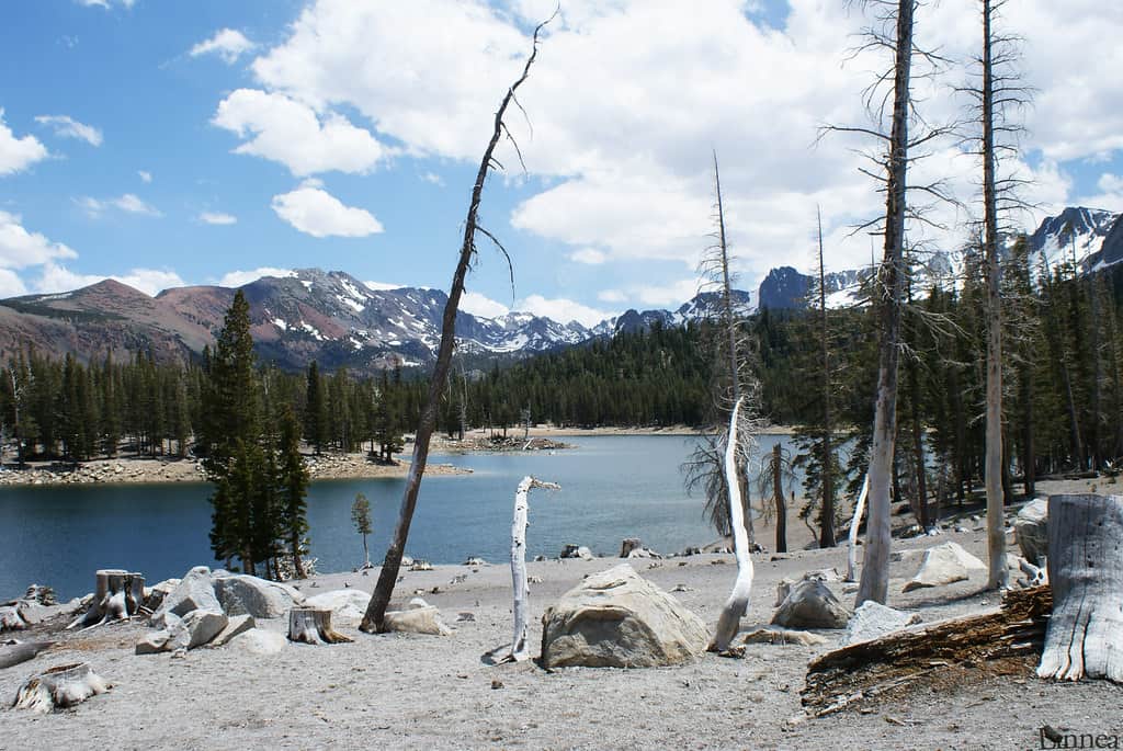
8. Horseshoe Lake
Distance: 1.8 miles round trip
Elevation Change: About 100 feet
Horseshoe Lake is a popular hiking destination in Mammoth’s Lakes Basin at the lend of Lake Mary Road. It is an easy hike, but it is also home to an unusual geological feature that makes this lake hike especially interesting.
There are CO2 gas seeps at Horseshoe Lake that have killed trees in the area. They are caused by volcanic activity in the area. The Mammoth Lakes area is located in the Long Valley Caldera, which is a large volcanic depression that formed from a massive eruption about 760,000 years ago.
The area is still geothermally active and the volcanic activity is responsible for the release of carbon dioxide gas through the soil in certain areas, including Horseshoe Lake. The gas can accumulate in low-lying areas and pose a risk to wildlife and humans if inhaled in high concentrations. Therefore, it is important to follow the designated trails and avoid getting too close to the seeps.
Most of the seeps are found at the beginning of the hike and they are all well marked. From there, the trail takes you through a forest of pine trees, with occasional views of the surrounding mountains.
Horseshoe Lake itself is a beautiful alpine lake with crystal-clear water. It’s a great spot for fishing, picnicking, and wildlife viewing.
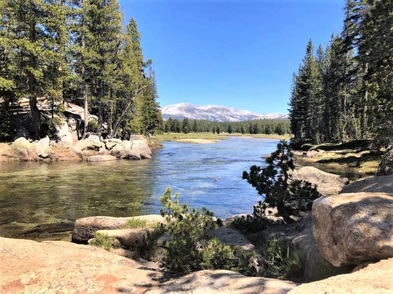
9. Tuolumne River Cascades via Pothole Dome
Distance: 2.4 miles round trip
Elevation Change: Minimal
I hate using the term “hidden gem” but this trail inside of Yosemite National Park in the Tioga Pass truly is. It is not a trail that is listed on brochures provided by the park and it is largely overlooked.
The trail begins at the parking area near Pothole Dome and heads along the road towards the Dome until you reach the base. Many people start climbing up the dome from there.
You can certainly take time to climb the dome. The views from the top are lovely and it will get your legs burning a bit which is great because the rest of this hike is mostly flat.
After you have climbed up and down the dome (or not) keep following the trail as it hugs the edge of Tuolumne Meadows, winding in and out of the forest.
After a little more than a mile you will reach the Tuolumne River which is picture perfect, especially during the snowmelt. You can continue to follow the creek for quite a while by scrambling on the granite that hugs the river and discovering the occasional path that pops up. The river’s edge is also an ideal place for a picnic,so have a seat and enjoy the cascades while you eat.
This hike made my list of my favorite easy hikes in Yosemite. See what else is on the list!
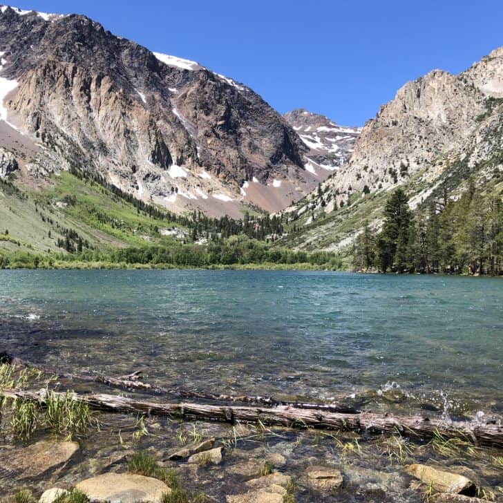
10. Lundy Canyon
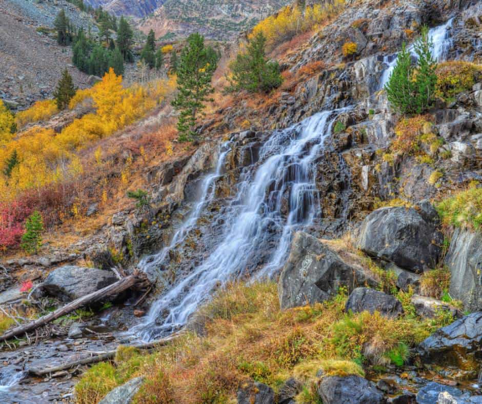
Distance: 4.6 miles round trip
Elevation Change: 600 feet
Lundy Canyon is a beautiful canyon located near Lee Vining in the Eastern Sierra Nevada Mountains known for its waterfalls, wildflowers and fall color. It is about seven miles from Lee Vining and the end of the appropriately named Lundy Lake Road.
The trailhead up Lundy Canyon to the falls is located at the Lundy Canyon Campground. The trail is considered moderately challenging, with some rocky terrain and steep sections but nothing too difficult.
The Lundy Canyon Falls are a series of cascading waterfalls surrounded by lush forests of pine and aspen trees, and the sound of the water rushing down the rocks creates a peaceful and serene atmosphere. Just imagine what it looks like during the peak of the fall color change!